Middle Bass on the Web - Your Source for Island Information


Home

News / Events  

News Archives/Wire 

Webmaster's Log

Welcome

Getting Here

General Info

Yellow Pages / Lodging   

Photos

Store   

Kid's Corner  

Navigation

Site Map Page 1

Site Map Page 2

Site Search  

History                             

Island History

Area History

Bibliography           

Links

Lake Erie Island Links 

Ottawa County Links

Fishing Info

News Links

Weather Links  

More Islands

Community

Calendar  

Free Stuff

Guest Book

Contact Us

Legal

About Us / Tips 


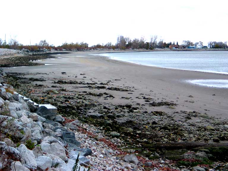
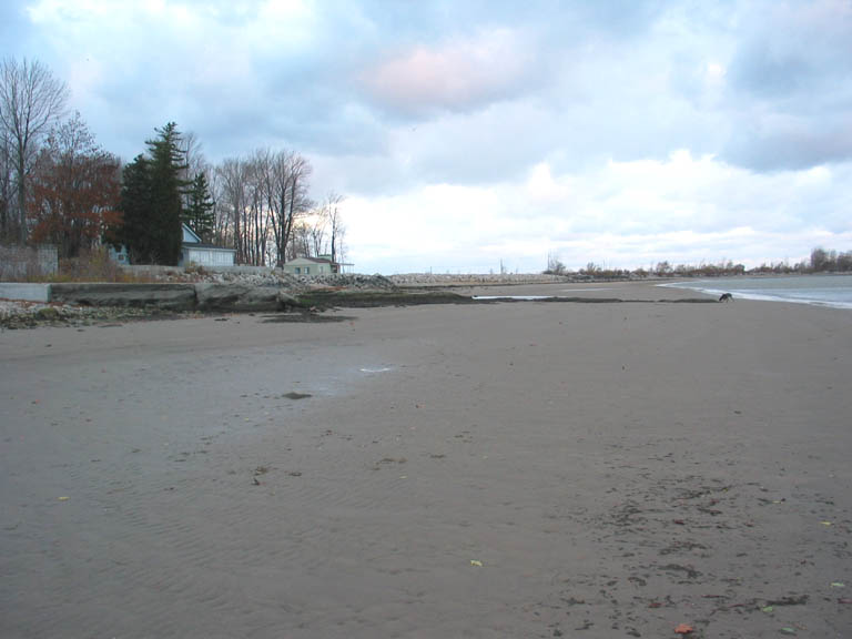
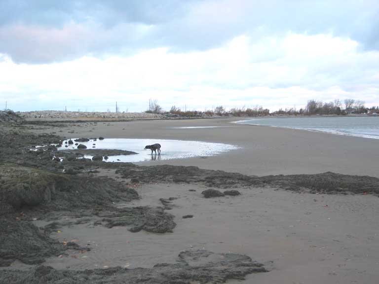
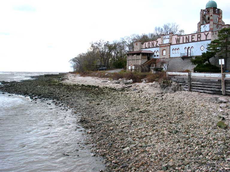
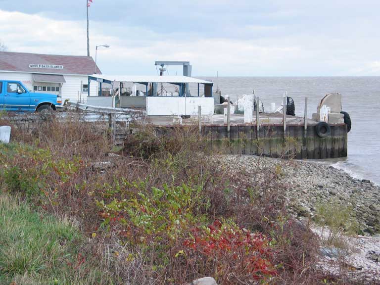
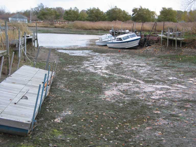
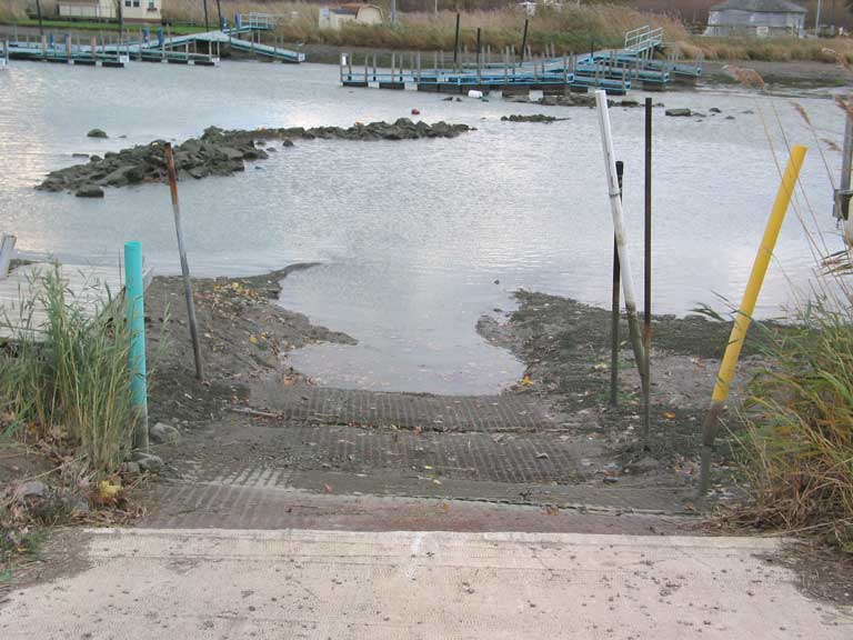
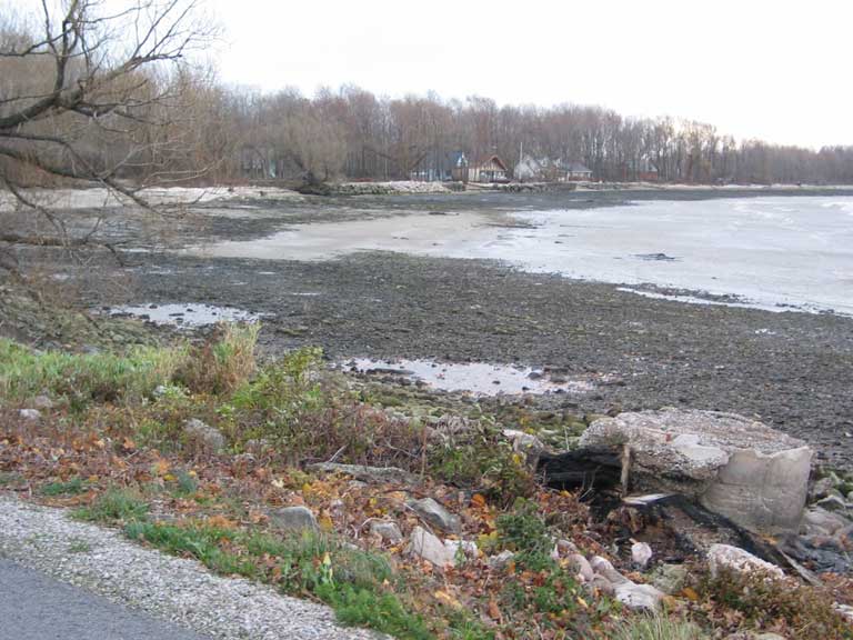
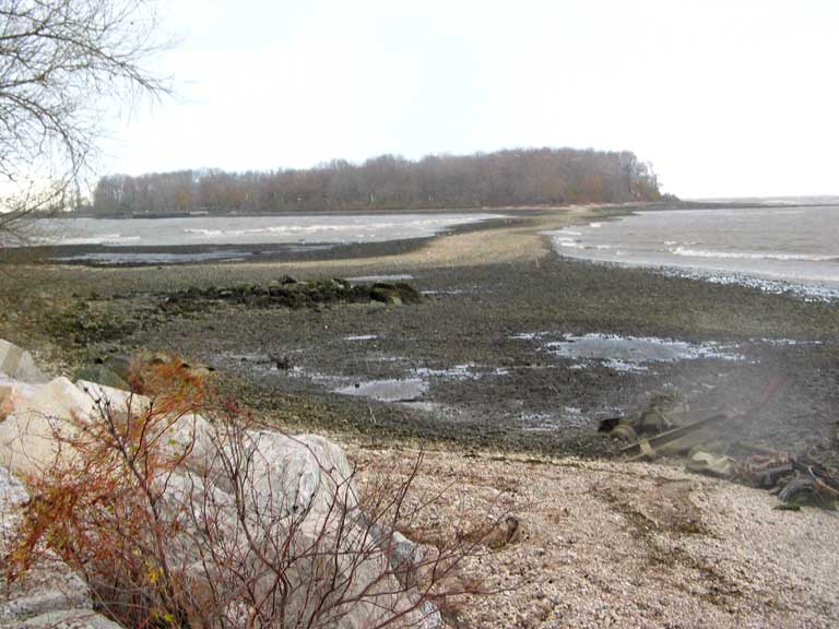
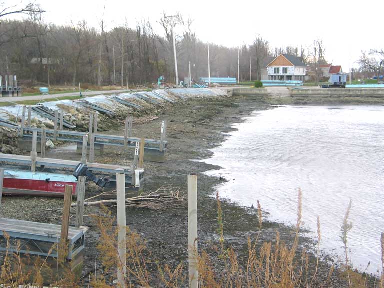
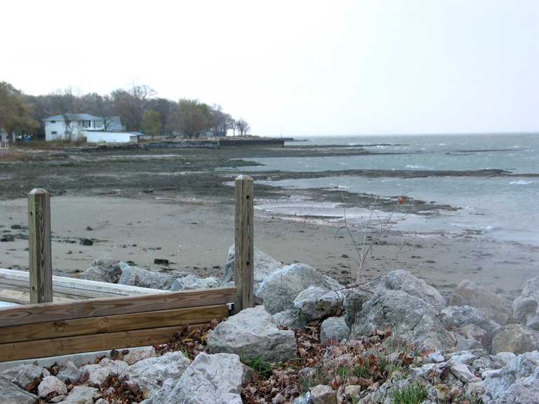
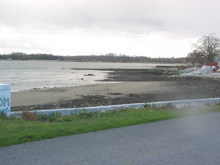
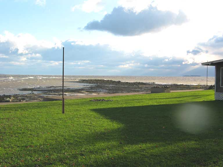
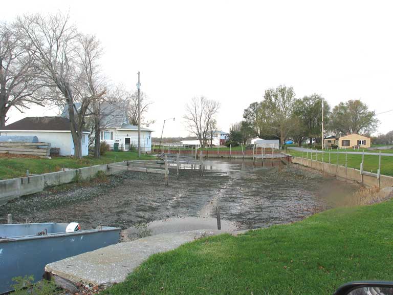
Seiche Conditions on November 11, 2003


Winds had been blowing at 30-60mph all night from the west and gusting even higher, so when I got up I took a look at the shore and decided I had to take pictures. These were all taken between 7:30 and 8:30 AM. The water was 4-5 feet below the normal low water mark, but by 10:30 AM the water had already come back up about 2 feet. The early Miller Ferry didn't run. Waves last night were supposedly 13-17 feet. Islanders have seen the water this low before, but it usually takes 2-3 days. This time, it took about 12 hours.


Did the government really think they could get rid of the beach at the airport?

More of the beach near the airport, taken near the Bretz Cabins

My dogs enjoyed the new beach

Low Water at the Lonz Winery

This shows that the water is 4-5 feet below the usual water line

Roesch's marina

Roesch's boat ramp and the Middle Bass Island Yacht Club

The roof blew off this new barn/garage on Anchor Lane

The southern edge of Burgundy Bay

The new road to Sugar Island

The Burgundy Bay marina

the East Point south shore

The East Point shore at Johnson's Cottages

The East Point Reef

Schmidlin's marina


All Contents Copyright © 2000-2003 by Middle Bass on the Web, Inc. All rights reserved.

Reproduction without written permission is forbidden for any purposes other than personal use.

Revised: 21 Jul 2008 06:54:50.

This page has been accessed times